photo by Saul Greenberg
Bonnington Traverse GPS and Maps (Near Castlegar, BC)
Summary
- 4 day backcountry ski tour
- can be done in less depending on snow conditions and desire
- stay in primitive huts (or tents)
- no glacier travel, but there is avalanche terrain
- ~48 kms total
|
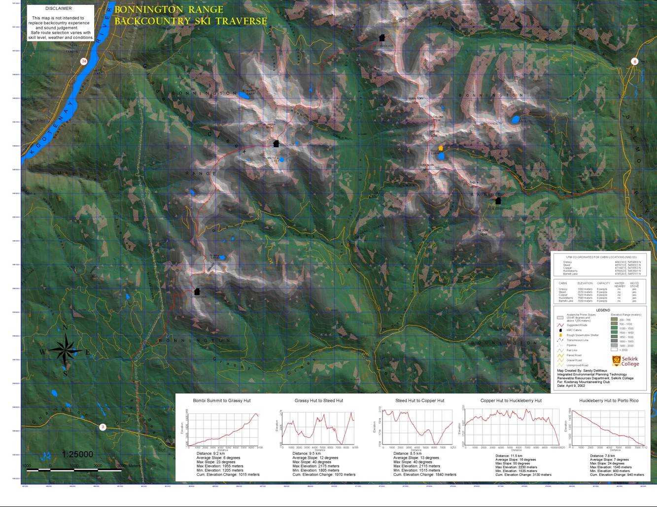
Bonnington Traverse Maps | |
|
GPS waypoints and tracks |
You can upload the Bonnington Traverse GPS waypoints and tracks to your GPS device and/or various GPS software packages (e.g., Google Earth, Garmin Basecamp, etc.) Waypoints include the cabin location and other landmarks. Cabin location is important as the ssnow-covered cabins are otherwise difficult to find. The Track shows the entire route in detail, including an escape route. GPS files come in many formats. The GPX format is likely the one that you will want to use. |
|
Booking the cabins |
Personal thoughts.
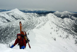
This wonderful ski tour forms a horseshoe between Highway 3 and Highway 6. Once you gain the height of the land, it mostly follows ridge crests. It is not pristine: there are skidoo roads at the beginning and end, and you will be hitting well-traveled skidoo trails along the way. But the ridges are gorgeous.
Most of the route is reasonable in terms of avalanches, but there are various exposed sections. You definitely want to be avalanche-knowledgeable, and have (and know how to use) avalanche gear. The ridges on the last day also have sections that are quite steep; you will likely have to bootpack some of them (marked on the map). Also, be prepared to bail, as snow and avalanche conditions can change rapidly. An escape route is included in the maps below.
The cabins must be booked ahead of time. While they are quite primitive, they are a luxury compared to a tent (especially on those soggy days). Since they only sleep 4 people, booking is required - if others are there, you won't fit into them. The cabins can be quite hard to find, as they are small and usually very snow covered. The logbooks have many reports of people arriving the night before only to tent as they could not find the cabin, even though it was only 100m away. Thus a GPS is invaluable: I've provided the maps and GPS waypoints / track below .
Details.
- Maps and GPS are provided above. The GPS file includes the waypoints and day by day track. Maps show the track and waypoints, as well as some text describing that day's route. The overview map gives a birds eye view of the route, while the others are more detailed day by day descriptions.
- Trailhead begins at Bobmi Summmit on Highway 3 near Castlegar, and ends on the Porto Rico road/parking lot on Highway 6 between Salmo and Nelson. The first several kilometers follow the powerline on a forestry road. While hitching back to the car is possible, your best bet is to try to leave a car at the end.
- Cabins must be booked from Kootenay Mountaineering. They are very small (about 4 people) and you will not be able to squeeze in if others have them booked. Costs are minimal.
- Other info. I have been told that Chick Scott's book has a written description of this trip. Kootenay Mountaineering also have pointers to various routes in the Bonnington Range .